
Datoteka:Maldives pol98.jpg
Veličina ovog prikaza: 400 × 599 piksela. Ostale razlučivosti: 160 × 240 piksela | 320 × 480 piksela | 1.014 × 1.518 piksela.
Vidi sliku u punoj veličini (1.014 × 1.518 piksela, veličina datoteke: 166 KB, MIME tip: image/jpeg)
Sažetak
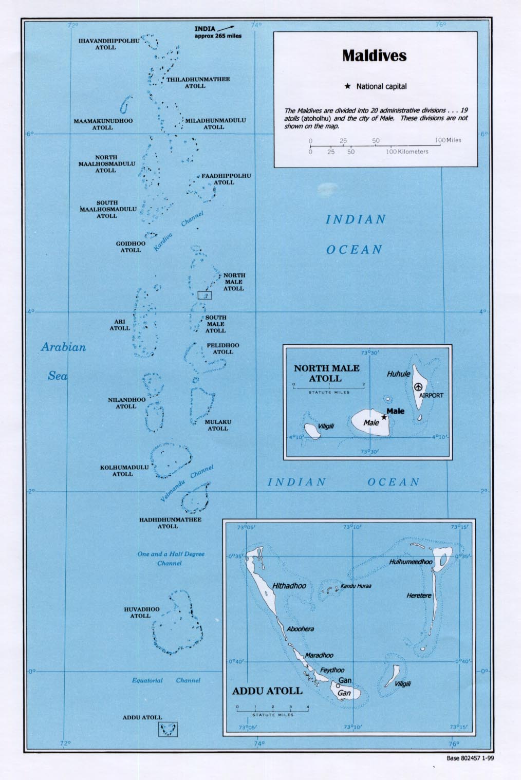
This is a map of the Maldives in 1998 made by the U.S. Central Intelligence Agency.
Licencija
This work is in the public domain in the United States because it is a work prepared by an officer or employee of the United States Government as part of that person’s official duties under the terms of Title 17, Chapter 1, Section 105 of the US Code.
Note: This only applies to original works of the Federal Government and not to the work of any individual U.S. state, territory, commonwealth, county, municipality, or any other subdivision. This template also does not apply to postage stamp designs published by the United States Postal Service since 1978. (See § 313.6(C)(1) of Compendium of U.S. Copyright Office Practices). It also does not apply to certain US coins; see The US Mint Terms of Use.
|
 | |
| Ova datoteka je identificirana kao slobodna od poznatih ograničenja po zakonu o autorskim pravima, uključujući sva povezana i srodna prava. | ||
Povijest datoteke
Kliknite na datum/vrijeme kako biste vidjeli datoteku kakva je tada bila.
| Datum/Vrijeme | Minijatura | Dimenzije | Suradnik | Komentar | |
|---|---|---|---|---|---|
| sadašnja | 20:12, 14. prosinca 2006. | | 1.014 × 1.518 (166 KB) | Kmusser | This is a map of the Maldives in 1998 made by the U.S. Central Intelligence Agency. Category:Maps of the Maldives |
Poveznice
Sljedeća stranica rabi ovu datoteku:
Globalna uporaba datoteke
Sljedeći wikiji rabe ovu datoteku:
- Uporaba na ar.wikipedia.org
- Uporaba na arz.wikipedia.org
- Uporaba na az.wikipedia.org
- Uporaba na bn.wikipedia.org
- Uporaba na en.wikipedia.org
- Uporaba na es.wikipedia.org
- Uporaba na fr.wikipedia.org
- Uporaba na gom.wikipedia.org
- Uporaba na io.wikipedia.org
- Uporaba na ko.wikipedia.org
- Uporaba na ne.wikipedia.org
- Uporaba na pl.wikipedia.org
- Uporaba na ru.wikipedia.org
- Uporaba na si.wikipedia.org
- Uporaba na uk.wikipedia.org
- Uporaba na uz.wikipedia.org
- Uporaba na vep.wikipedia.org
- Uporaba na zh.wikipedia.org